Noyo HarborBlue EconomyVisioning, Resiliency& Implementation Plan
The Plan is made possible with grant funding from the California Coastal Commission and will result in several updates to both the City of Fort Bragg and County of Mendocino Local Coastal Programs. Regular updates to our Local Coastal Program (LCP) help ensure future development strengthens our unique coastal character, provides a sound framework for economic growth, and protects coastal resources and public access to our coastline. Our goal is to integrate findings of The Plan into an LCP update, while accomplishing the following:
1. Inclusive Regional Collaboration & Agency Coordination
Before work on The Plan began, several weeks were dedicated to developing a communication and engagement plan (CEP), which primarily functions through this website. A copy of the CEP can be found at the bottom of the Home page. The CEP functions as the overall charter for The Plan, providing the public and stakeholders a clear guide and understanding of roles, responsibilities, actions, accountability and outcomes of the project. Basically, Who, Where, When and How to engage in this three-year planning effort.
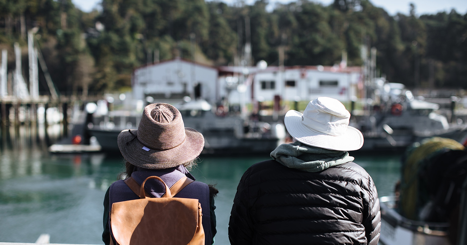
We want to hear from you and we need your input to develop an inclusive coastal economy in an environmentally sustainable manner.
2. Address Effects of Climate Change
Impacts of a changing climate are complex and often interrelated. The Mendocino Coast is faced with numerous climate challenges within the natural environment, our economy, and social conditions. For example, Fort Bragg is ground zero for the urchin barren / kelp dynamic, which started with warming waters and the sea star wasting disease. This contributed to the loss of 97% of our kelp forests, which nurture all sorts of marine ecosystems and play an important role in carbon sequestration for the planet. The loss of kelp has strained our fisheries, and the changing fisheries have weakened our local fleet, which is evidenced in the social/economic vulnerability of our community members who use, reside and work on the water.
The Plan seeks to better understand the dynamic of climate impacts such as these through the collection and synthesis of baseline information pertaining to existing environmental, physical, social and economic conditions of Noyo Harbor. The Plan also seeks to gain a better understanding of community priorities and incorporate this sentiment into resiliency goals, policies and programs. Several studies have been identified, including:
- Site‐specific analysis of the scenarios and impact of sea level rise, tsunami hazards, and increased erosion due to increased wave action within the harbor to mitigate expected sea level rise and inform future development considerations. This analysis will use the best available science and will be used to identify opportunities and limitations for proposed development, infrastructure needs, and adaptation needs in the harbor.
- Technical studies including an aquaculture feasibility study that incorporates a water quality assessment and considers future climate impacts on potential aquaculture operations; as well as an analysis of special district management of the harbor.
- Parcel inventory to identify current land use(s), economic contribution, boundaries, and historic status. Space within the harbor is limited, and a comprehensive review of existing development is needed to inform strategy for increasing overall productivity.
- Harbor facilities conditions assessment including inspections to assess and document the present condition of facilities and remaining life in order to better understand chronic maintenance needs, operational issues or concerns. The assessment is expected to focus on structural integrity, mooring basin analysis including size, vessel type, term of lease, condition of docks, etc.; and identify needed harbor improvement/projects, including repair and replacement costs.
3. Environmental Justice
The area in and around Fort Bragg was identified by the federal government for the Mendocino Indian Reservation (1856-1866) where California tribal communities were forcibly displaced. Over the following decades, the regional economy boomed with resource extractive industries such as logging and fishing. The changing climate, regulations, and unsustainable past practices caused declines in these industries, and have exposed a vulnerable environment and fragile economy.
Community outreach efforts are designed to achieve meaningful engagement through an equitable process, and to amplify voices that have been left out of the conversation. Our success in achieving resiliency will depend on inclusive community planning, identifying opportunities for transformational investment and to implement actions together.
4. Focus on Public Benefit
Positioning our region for Blue Economy investment will not only benefit nearshore ecosystems and improve quality of life and livelihood for locals – this effort will also enrich the coastal experience of visitors, bolster the economy of California, as well as inform the body of global research tasked to develop solutions to a rapidly changing climate.
Local Coastal Program
Findings from The Plan will be integrated into the City’s Local Coastal Program (LCP). A LCP is a planning tool used by local governments to guide development within California’s coastal zone in partnership with the California Coastal Commission. LCPs provide guidance for future development and protection of coastal resources. It gives the City permitting authority over most development – although the Coastal Commission retains permanent jurisdiction on tidelands, submerged land, public trusts and acts on appeals from certain local decisions. California’s Coastal Commission reviews and approves any amendment to a certified LCP.
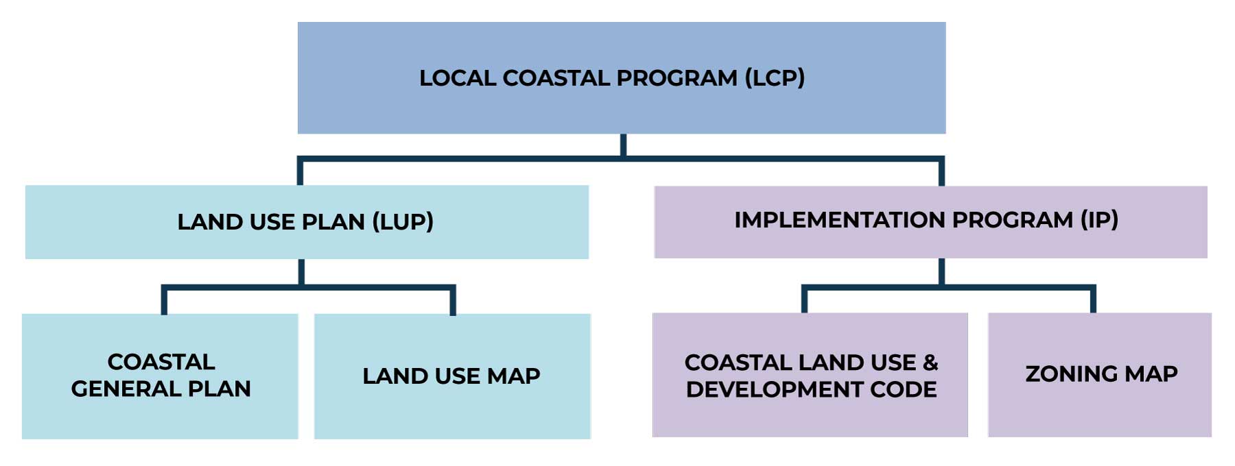
The City of Fort Bragg adopted its initial LCP in 1980 and it was certified by the Coastal Commission on July 14, 1983. Over the years, several amendments have been adopted and certified; the last comprehensive update occurred in August 2008. The City’s LCP is comprised of a Land Use Plan and Implementation Program. The Land Use Plan includes the Coastal General Plan and Land Use Map, while the Implementation Plan includes the Coastal Land Use and Development Code and Zoning Map. It reflects distinctive qualities of Fort Bragg, while also addressing regional and statewide interests, and conforms to Coastal Act goals and policies.
Links:
• LCP Grant Guidelines
• LCP Update Guide