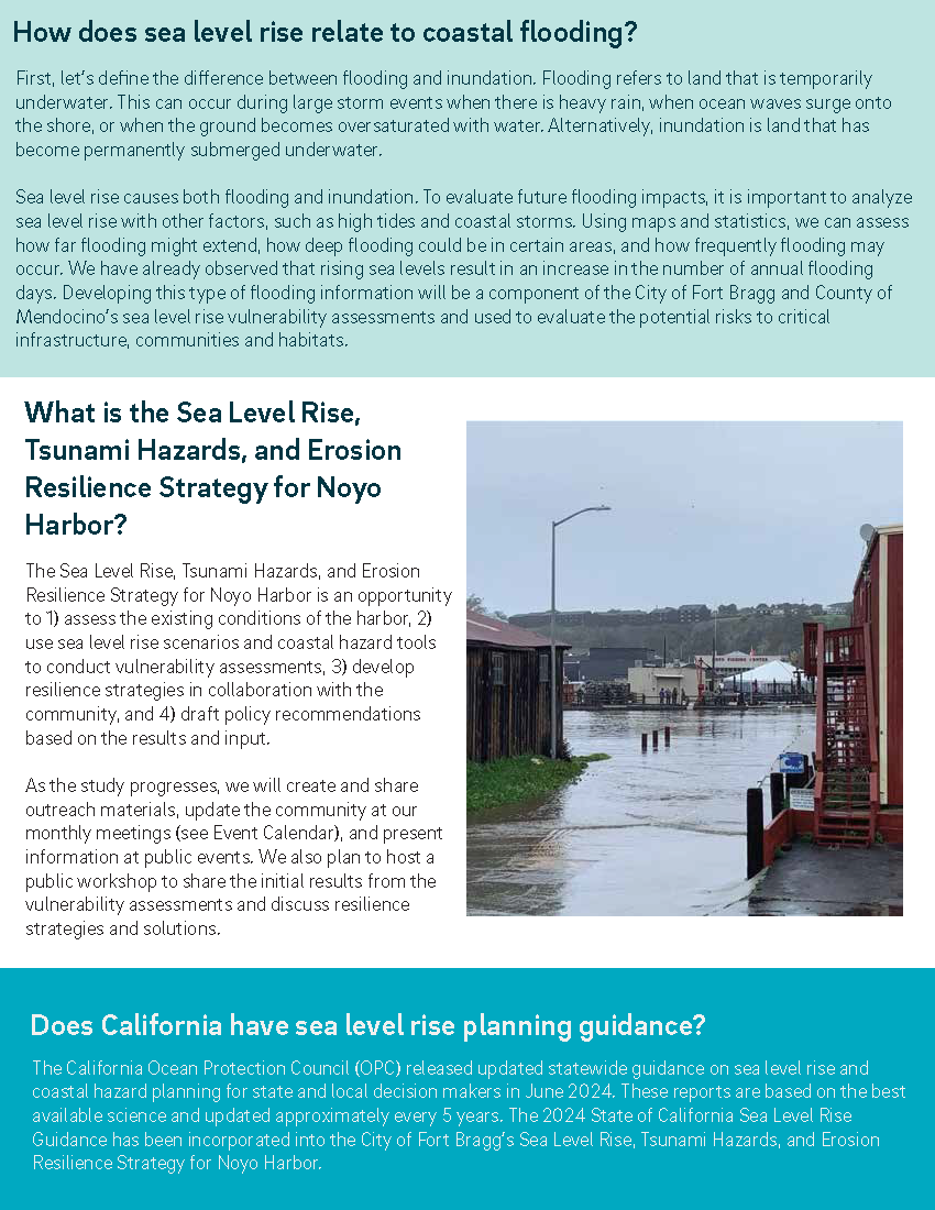
UPDATE: ESA Vulnerability and Risk Assessment for City of Fort Bragg's Sea Level Rise, Tsunami Hazards, and Erosion Resilience Strategy
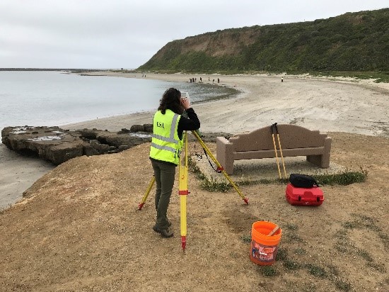
The Vulnerability and Risk Assessment for the Noyo Harbor Sea Level Rise, Tsunami Hazards, and Erosion Resilience Strategy (SLRRS) is a comprehensive evaluation aimed at understanding and mitigating the impacts of coastal hazards on Noyo Harbor and adjacent areas. This assessment is part of a broader initiative funded by the California Coastal Commission and conducted in collaboration with the City of Fort Bragg, Noyo Harbor District, and various consulting partners. The Vulnerability and Risk Assessment serves as a foundational document for the development of a robust resilience strategy that will guide future planning and investment in Noyo Harbor, ensuring its continued functionality and sustainability in the face of climate change and coastal hazards.
ESA memo with sea level rise scenarios for City of Fort Bragg SLR, Tsunami Hazards, and Erosion Resilience Strategy
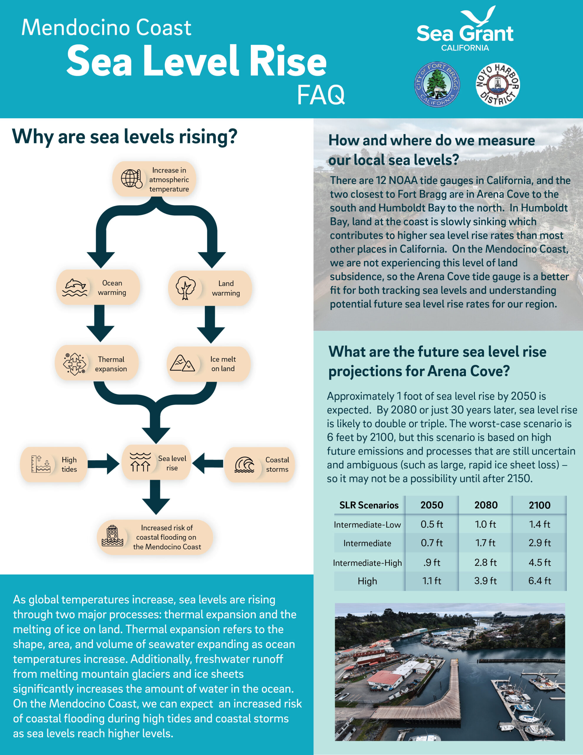
This memo presents a preliminary assessment of sea level rise (SLR) scenarios to be used by the ESA team for the City of Fort Bragg SLR, Tsunami Hazard, and Erosion Resilience Strategy. The SLR scenarios presented in the document below will be used as part of the technical analyses and risk assessments of vulnerable coastal assets and resources in the city over a range of time horizons. These SLR scenarios presented in this memo are based on the latest State of California guidance documents, including the State of California’s Sea Level Rise Guidance (OPC 2024) and the California Coastal Commission’s (CCC) Sea Level Rise Policy Guidance (CCC 2024).
ESA recommends using three future conditions timescales for the City of Fort Bragg SLR, Tsunami Hazard, and Erosion Resilience Strategy to examine the SLR impacts by incremental amounts: 1 foot of SLR occurring by 2050 (near term), 3 feet of SLR by 2070-2100 (intermediate term), and 6 feet of SLR by 2100+ (long term). The method involves identifying specific amounts of SLR, or thresholds, at which assets become vulnerable. The SLR guidance, projections, and threshold approach are summarized in the document below.
ESA Memo – SLR Scenarios for City of Fort Bragg SLR Resilience – 2025-02-10
Meet Environmental Science Associates
Nestled between the majestic coastal ranges and the dramatic Pacific Ocean, the City of Fort Bragg is one of California’s most treasured and unique cities. Environmental Science Associates (ESA) is engaged and committed to developing a Sea Level Rise Resilience Strategy that will guide and protect Noyo Harbor for future generations.
ESA is known for leading multi-objective projects that integrate coastal hazard and economic analyses and vulnerability assessments with climate change adaptation and restoration planning for infrastructure systems, benefiting communities and the environment.
ESA’s team includes civil and coastal engineers, geomorphologists, technical modelers, ecologists, cultural resources specialists, public engagement facilitators, and policy and regulatory experts who are committed to providing a tailored solution for Noyo Harbor. The same team members are working with the County of Mendocino on its Sea Level Rise Resilience Strategy for the unincorporated coastal areas. In partnership with the City of Fort Bragg, ESA will explore innovative and effective solutions for the shoreline environment to thrive in the face of a rising sea.
Sea Level Rise FAQs
Tools & Resources
Sea Level Rise Guidance
- 2024 DRAFT State of California Sea Level Rise Guidance
- Global and Regional Sea Level Rise Scenarios for the United States
Historic Arena Cove High Tide and Flooding Information
- NOAA – Historic Top-10 Water Level Events
- NOAA – Arena Cove Historic Annual Flood Days
- NASA – Arena Cove Historic Observed Flooding Days
Future Arena Cove Sea Level Rise and Flooding Projections/Scenarios
- NOAA – Arena Cove High Tide Flood Projections
- NASA – Arena Cove High Tide Flooding Days Projections
- Interagency Sea Level Rise Projections Tool – Find your closest tide gauge, then use the interactive map to view different sea level rise scenarios at different timescales.
- USGS – Coastal Storm Model (CoSMoS) – This is the only tool that measures both sea level rise and coastal storm flooding risk. It is expected that USGS may release CoSMoS storm modeling results for the Mendocino area (north of Arena Cove) by the end of 2024.
- NOAA – Coastal Flood Exposure Viewer – You can view sea level rise, FEMA flood risk areas, and high tide flooding areas and save the maps.